
Trace a Rosemount Street Directory by Address
Use an exact Rosemount address as the starting point, not a guessed occupant name. Dakota Property Information accepts a building number and a full or partial street, and its map can resolve similar street segments. The returned parcel is the anchor for a street directory search. It can show the situs address, taxpayer or owner field, municipality, tax description, tax and building panels, and subdivision information. A result is parcel evidence, not a complete list of people at that location.
Keep the street spelling exactly as the county displays it. Save the PID, the full legal description, and the date of the result before moving to the next parcel. A long road can pass vacant land, public tracts, a cemetery, a school, or a multi-unit parcel. Those places explain gaps in a street-by-street review. The county has not documented a public whole-street owner export, so a careful street directory trail is built one address and one parcel at a time.
- Confirm the address. Enter the house number and select the matching street result, or click the parcel on the county map when the address is uncertain.
- Record PID and owner fields. Copy the parcel identifier, situs address, legal description, and the displayed taxpayer or owner information before comparing nearby parcels.
- Follow the deed chain. Use the legal description and party names in Dakota County RecordEASE to locate the purchase document and earlier conveyances.
- Respect the voter limit. MNVotes confirms a supplied registration match with a name, date of birth, and address. It does not provide a browseable street roster.
- Ask for historical context. Request exact directory, telephone-book, or reverse-directory titles from the Lawshe archive, then compare any address entry with the same parcel and deed trail.
Note: A parcel record can identify a title or tax relationship without proving every person who has lived at the address.
Rosemount Street Directory Search Fields
The county property viewer is location-first. An owner-name starting box was not visible in the public interface, which matters when a street directory question begins with a name instead of a place. Entering only part of a street can surface suggestions, while a map click opens the parcel panel. The printable Property Details route may be blocked by a browser pop-up setting. Treat the map layers as geographic context, then confirm title facts in the recorded-document system.
| County field | Input type | Required | Rosemount use |
|---|---|---|---|
| Building number | Text with autocomplete | No | Enter the number and choose a suggested address. |
| Street or address | Text with autocomplete | No | Full and partial address searches are supported. |
| Parcel ID | Text | No | Dashes are optional; the county sample uses 34-02000-08-010. |
| Map parcel | Map click | No | Centers the parcel and opens its result panel. |
| Property, Tax, Building tabs | Result panels | No | Show parcel, tax, and building information after a match. |
| Basemap, layers, legend | Map controls | No | Help read parcel geometry; the live layer set can change. |
The public GIS service also exposes field names such as TAXPIN, site address, building number, and update date in its metadata. That technical detail does not authorize bulk collection. Dakota County prohibits bulk downloads and scraping from the property tool. For a Rosemount street directory task, open the individual parcel, record only the fields needed to evaluate that parcel, and use the custodian when a wider authorized record request is needed.
Rosemount Street Directory Address Labels
A common mistake is to treat every address shown near a parcel as the same thing. The situs address is the physical location used for map placement. A tax mailing address is correspondence information and can be outside Rosemount. The legal description is the title identity used in deeds and plats. A postal address confirms delivery geography, but it does not change parcel boundaries. Compare each label before assuming two records belong to one street address.
Rosemount has a recorded village layout from 1866, early Dodd Road context, a township and village merger in 1971, and statutory-city status from 1975. No verified citywide street-renumbering or street-renaming project was located. Old material can instead use a township, post-office, road variant, lot and block, or section-township-range description. Match an older entry through the plat and legal description, then ask Rosemount Community Development or Dakota GIS for confirmation when the physical address remains uncertain.
- Parcel / PID
- A parcel is a defined tract on the county map. Its PID is the county tax parcel identifier, not a street number and not a code to decode for ownership.
- Situs address
- The physical location of the parcel. It is the best label for mapping nearby parcels along a Rosemount street.
- Tax mailing address
- The correspondence address for tax information. It may be different from the situs address and does not establish occupancy.
- Plat
- A recorded map that connects a subdivision lot and block to legal land identity. It can bridge a modern address and an earlier tract description.
- Criss-cross directory
- A reverse address arrangement, if a particular volume includes one. Lawshe must confirm the exact Rosemount titles and years.
Note: A PID, a street address, and a legal description should agree before a name from one record is attached to another.
Rosemount Street Directory Record Coverage
Each address-keyed record answers a narrower question than the one before it. The property result establishes the parcel. The deed index establishes recorded parties and title events. A tax statement gives property and taxpayer context, while city records can document a dated public process at an address. The MNVotes tool is deliberately a known-person registration check rather than a street directory. Combining these limited records is more reliable than forcing one source to answer every question.
| Address record | Custodian | What it can show | Access route |
|---|---|---|---|
| Property Information | Dakota County PT&R | Owner or taxpayer, situs and mailing fields, PID, descriptions, tax and building panels | Free address or PID search |
| GIS parcel layer | Dakota GIS | Parcel geometry, site address, building number, PID, map context | Viewer map, one parcel at a time |
| Recorded documents | Dakota County PT&R | Grantor, grantee, document type, date, number, legal description, title system | RecordEASE account or recorder counter and mail |
| Tax statement | Dakota County | Property details, classifications, values, payable-year tax material | Current and three prior years online |
| Special assessment request | Rosemount Finance | PID-linked assessment information | Request form, $20 per parcel, generally two business days |
| Permit or code record | Rosemount departments | Address, project or inspection process, and public portions of related records | Specific city records request |
Neither a tax statement nor a deed is a household roll. The county warns that a new parcel can be pending, and a no-result can call for a normalized street spelling, directional-prefix check, PID search, or a question to Dakota GIS rather than a conclusion about the property.
Rosemount Street Directory Deed Timing
RecordEASE is the title side of the Rosemount street directory path. After an address produces a PID and legal description, search the current owner or grantee, the legal description, and the document type. The purchase instrument identifies the earlier grantor. Search that prior party as a grantee for the same land description, then repeat. Check the document number or book and page, recording date, instrument type, Abstract or Torrens status, and the legal description at every handoff. A trustee deed, estate conveyance, or mortgage record is not interchangeable with a standard sale deed.
The county describes abstract documents as indexed back to July 8, 1993, while index completeness continues to improve. It also displayed several operational dates in August 2026: abstract and Torrens computer-index activity through August 20, abstract verification through August 19, and original documents mailed through August 17. Those dates report workflow status, not a historical start date or proof that all earlier material is missing. When an online result stops, use the PT&R counter, mail request, book and page route, and Lawshe plat material.
The screenshot comes from the county's RecordEASE sign-in and index entry. Authenticated search fields and a live sample result were not available for inspection, so exact post-login sort controls and display labels should be confirmed with the custodian.
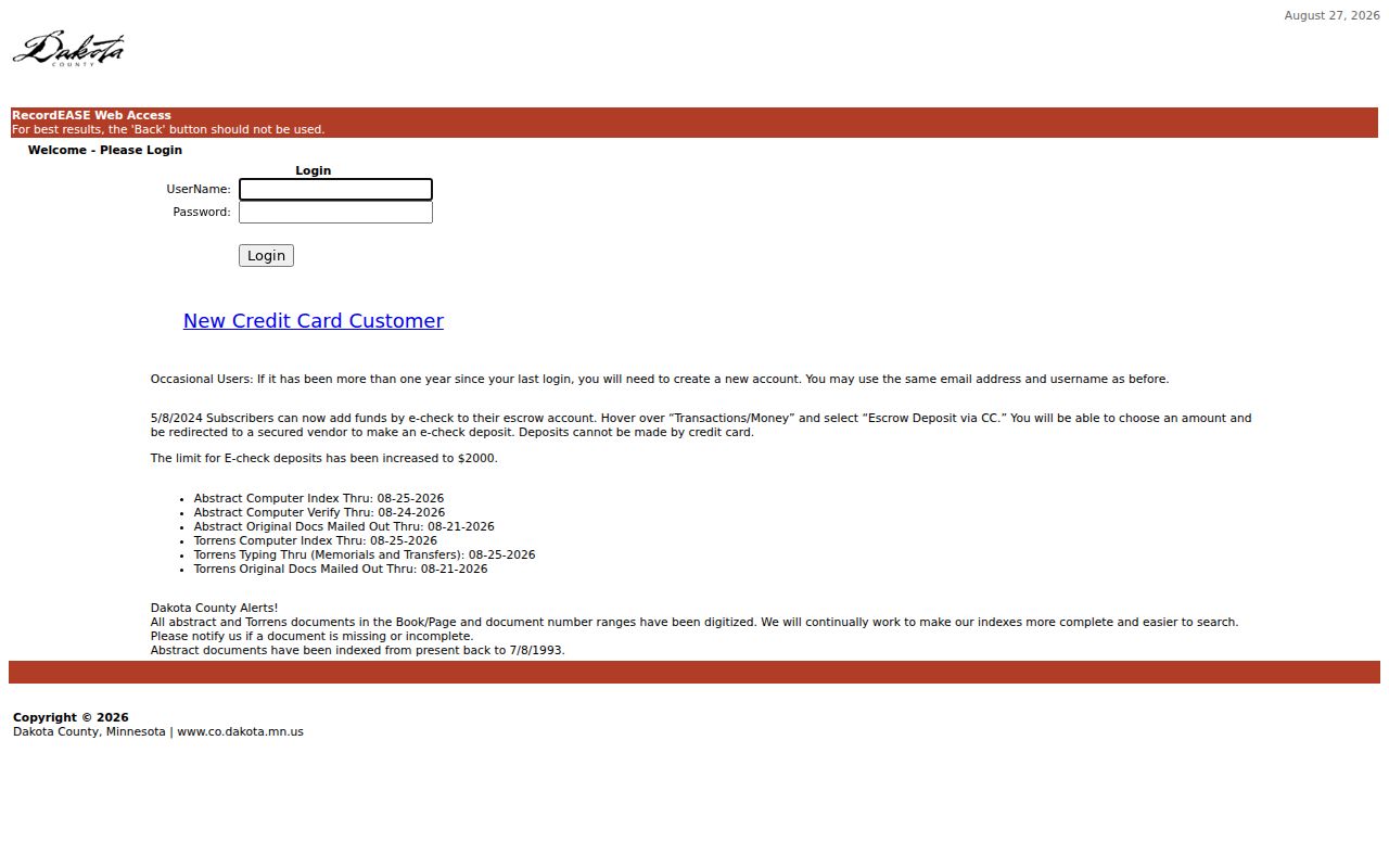
The index screen marks the transition from a confirmed Rosemount parcel to a recorded-document request. It does not replace the legal-description check that keeps two similarly named parcels from being merged.
Note: A paid document image or copy may be needed to verify a title event; the portal does not promise free images for every record.
Rosemount Street Directory Request Paths
Building permits, inspections, and code activity can date work at an address, but no public Rosemount permit or code-case search index was located. Community Development material identifies applications and plan requirements, and the code process can include complaint, inspection, notice, correction, reinspection, and citation stages. Ask for a specific address, date range, and record type rather than asking for a broad neighborhood list. The city can then identify public portions and any required redactions.
The city’s records-request instructions provide the municipal route. Minnesota Government Data Practices Act requests should name the custodian, describe the requested data and time period, and state whether inspection or a copy is sought. Public data are generally available for inspection at reasonable times, while copies can carry actual costs. This is a useful fallback when the map, tax statement, and deed index do not carry the needed address-specific record.
The screenshot comes from the Rosemount public-records request screen. It points to the request channel, not to a public person-by-address database.
Use the city channel for a narrow address record, such as a dated permit or a code file, after the parcel and legal description have been confirmed through Dakota County records.
Walk a Rosemount Street Map
The Dakota GIS method is a parcel walk, not a public street roster. Start at one confirmed address, zoom until parcel lines and street labels are readable, then click each parcel that touches the road segment. For every result, retain the PID, situs address, legal description, and map context. A corner parcel may be addressed from the cross street. A parcel that looks like a home from the road can instead be a common area, park, school, church, cemetery, roadway, or institutional tract.
When the map returns no parcel, use the nearby intersection, an adjacent PID, or the exact displayed street spelling. New parcels can have a pending status. Map layers help with geographic context, but ownership and title still need the Property Information panel and, when relevant, the recorded-document route. Keep public and institutional parcels in the street notes because they often explain gaps between residential addresses.
Rosemount Street Directory Voter Boundaries
MNVotes cannot be used to browse everyone on a Rosemount street. Its registration match needs a known first and last name, date of birth, and address path. A result is a match check, not a household census. A nonmatch can reflect a spelling variant, address formatting, a recent move, a processing delay, or protected status. It should not be used to conclude that a person is absent from the city or a particular address.
Minnesota’s public voter-information list is a separate controlled request under Minn. Stat. § 201.091. A local geography request can have name, address, birth year, voting history, and district fields, but protected voters are withheld and the file has purpose and disclosure limits. It cannot identify nonregistered household members and should never be republished as an informal street directory.
Rosemount Street Directory Property Watch
Dakota County’s Property Watch is a current alert layer for a parcel or name, not a way to reconstruct an old street directory. The free service can watch a name, legal description, or property and send an email when a future recorded document matches. The notice can include the matched party name, recording date, document number, and document type. It is useful for a property owner monitoring later filings, but it does not backfill the earlier deed chain.
Common names can create false-positive notices. Keep the legal description with the alert result before assuming the filing belongs to a Rosemount address. Property Watch also cannot establish who is living at a site, and it should not be used as a substitute for an actual title search. For older transactions, return to RecordEASE, the recorder’s counter or mail channel, and the parcel record. The county’s 2025 budget described the initiative as part of a wider PT&R access system that also includes managed in-person service.
Rosemount Street Directory Privacy Limits
A street directory built from official records is not a list of every person on a road. Public parcel data focus on land and a taxpayer or owner relationship. MNVotes requires a known person’s identifying details and does not browse a street. The public voter-list route is controlled by Minnesota law, excludes protected voters, and is not a complete count of people at any address. Utility customer records and motor-vehicle address data are not general public street-search sources.
Historic directories and newspapers can add a dated household clue only when their title, format, and address match are confirmed. Lawshe Memorial Museum holds directories, telephone books, census material, plat maps, newspapers, obituary files, and related county history sources, but its exact Rosemount reverse or criss-cross shelf years have not been published. For the collections themselves, use the Rosemount Directory Book route after verifying the parcel’s historic form.
Lawful use. Rosemount address records are for personal, historical, property, family, and civic research. Do not use a record to stalk, harass, intimidate, or harm any person.